Nason Creek LWP Alcove Acquisition

|
Chelan-Douglas Land Trust; Nason Creek LWP Alcove Acquisition (#11-1372)
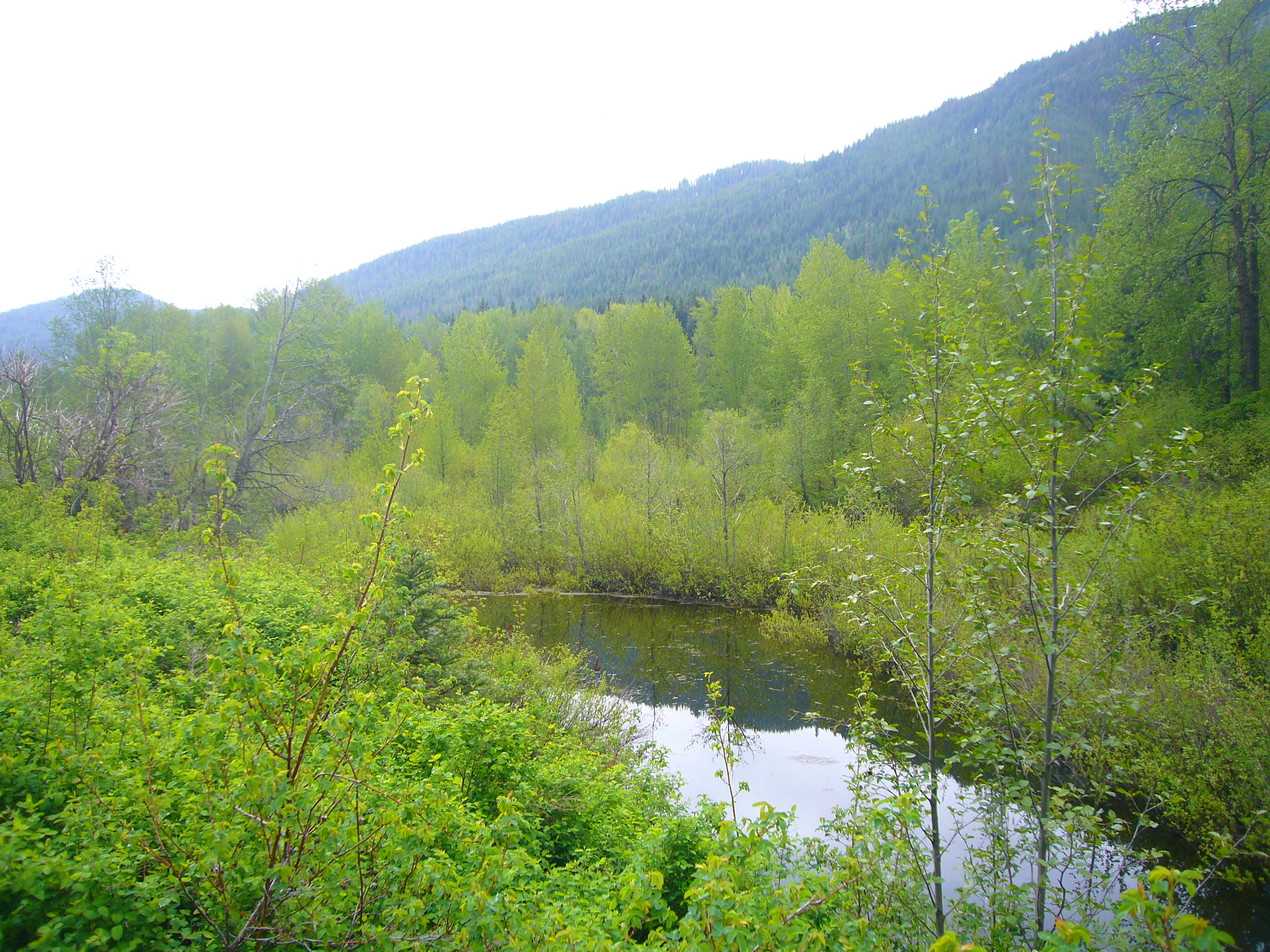
05/25/2011, Attachment #148761, Parker Pond
|
|
|
|
|
The Chelan-Douglas Land Trust seeks to acquire up to 15 acres in the Lower White Pine Reach of Nason Creek, that flows into the Wenatchee River, a tributary of the Columbia River. The Lower White Pine Alcove at RM 11.2-11.5 would protect both sides of the riverbank for 1100 feet (over 2200 feet overall). The projhect would also permanently protect acres of floodplain and a year-round watered alcove that was the former main channel of Nason Creek.
Nason Creek is a Category 2 stream, a major spawning area for endangered spring Chinook and steelhead and a core area for threatened bull trout ). Tier 1 actions are to “protect existing riparian habitat and channel migration floodplain function.” Using the Bureau of Reclamation reach assessment recommendations, these properties were ranked among the highest of 70 private holdings for protection in the 10 miles between RM 4.6 and 14 constituting the Upper White Pine, Lower White Pine, and Kahler reaches. This site is within the 2.5 mile Reach 3, in which the Chelan PUD's 2010 spawning survey reported 33% of the spring Chinook redds for all of Nason Creek, representing 19% of the redds in the Wenatchee Basin. For steelhead, 27% of the redds in the Wenatchee Basin were in Nason Creek, and most of the spawning was in Reach 3.
.
|
|
General Area:
|
|
Nason Creek
|
|
County:
|
|
Chelan
|
|
Legislative District:
|
|
12
|
|
Congressional District 2022:
|
|
08
|
|
Salmon Recovery Regions:
|
|
Upper Columbia River
|
|
Watershed Administrative Unit:
|
|
Lower Nason
|
|
HUC8:
|
|
Wenatchee (17020011)
|
|
WRIA:
|
|
Wenatchee
|
|
Sections:
|
|
03
|
|
Township:
|
|
T26NR16E
|
|
Coordinates:
|
|
47.77801861
-120.83050722
|
|
|
| Worksite Name | Scope of Work |
|
Ponds (#1)
|
Administrative costs (Acq), Land, Standard Incidentals, Stewardship plan, Survey (Acq)
|
| | |
Amounts may not be complete
| Worksite Name | | Property Name | | Actual Acquisition
Acres | Actual Acquisition
Cost |
|
Ponds (#1)
|
|
Property 1 - Private Landowner
|
|
8.43
|
$201,987
|
|
Ponds (#1)
|
|
Property 2 - Private Landowner
|
|
6.56
|
$152,251
|
| | | | Total | 14.99 | $354,238 |
Amounts may not be complete
| Milestone Name | Target Date | Description |
|
Project Start
|
12/08/2011
|
|
|
Cultural Resources Complete
|
03/31/2012
|
Exempt for Executive Order 05-05 if no demolition. If demolition, then comply with EO 05-05 prior to demolition.
|
|
Progress Report Due
|
06/30/2012
|
|
|
Annual Project Billing Due
|
07/31/2012
|
|
|
Progress Report Due
|
12/31/2012
|
|
|
Order Appraisal(s)
|
02/01/2013
|
For Click property
|
|
Order Appraisal(s)
|
02/15/2013
|
For Parker and Parker (WSDOT) properties
|
|
Order Appraisal Review(s)
|
04/01/2013
|
For Click property
|
|
Order Appraisal Review(s)
|
05/01/2013
|
For Parker and Parker (WSDOT) properties
|
|
Purchase Agreement Signed
|
06/01/2013
|
For Parker and Parker (WSDOT) properties
|
|
Purchase Agreement Signed
|
06/01/2013
|
For Click property
|
|
Progress Report Due
|
06/30/2013
|
|
|
Acquisition Closing
|
07/31/2013
|
For Parker and Parker (WSDOT) properties
|
|
Annual Project Billing Due
|
07/31/2013
|
|
|
Recorded Acq Documents to RCO
|
07/31/2013
|
For Parker and Parker (WSDOT) properties
|
|
Environmental Assess Complete
|
11/30/2013
|
For Parker and Parker (WSDOT) properties
|
|
Environmental Assess Complete
|
11/30/2013
|
For Click property
|
|
Acquisition Closing
|
12/01/2013
|
For Click property
|
|
Recorded Acq Documents to RCO
|
12/31/2013
|
For Click property
|
|
Funding Acknowl Sign Posted
|
12/31/2013
|
|
|
Progress Report Due
|
12/31/2013
|
|
|
Agreement End Date
|
06/30/2014
|
|
|
Stewardship Plan to RCO
|
09/30/2014
|
|
|
Final Report Due
|
09/30/2014
|
|
|
Final Billing Due
|
09/30/2014
|
|