Save as PDF
Washington State Recreation and Conservation Office
Project Snapshot
PRISM Project #15-1058 (Completed)
Lower Bear Creek Natural Area Additions
    Project Details    
King Co Water & Land Res; Lower Bear Creek Natural Area Additions (#15-1058)

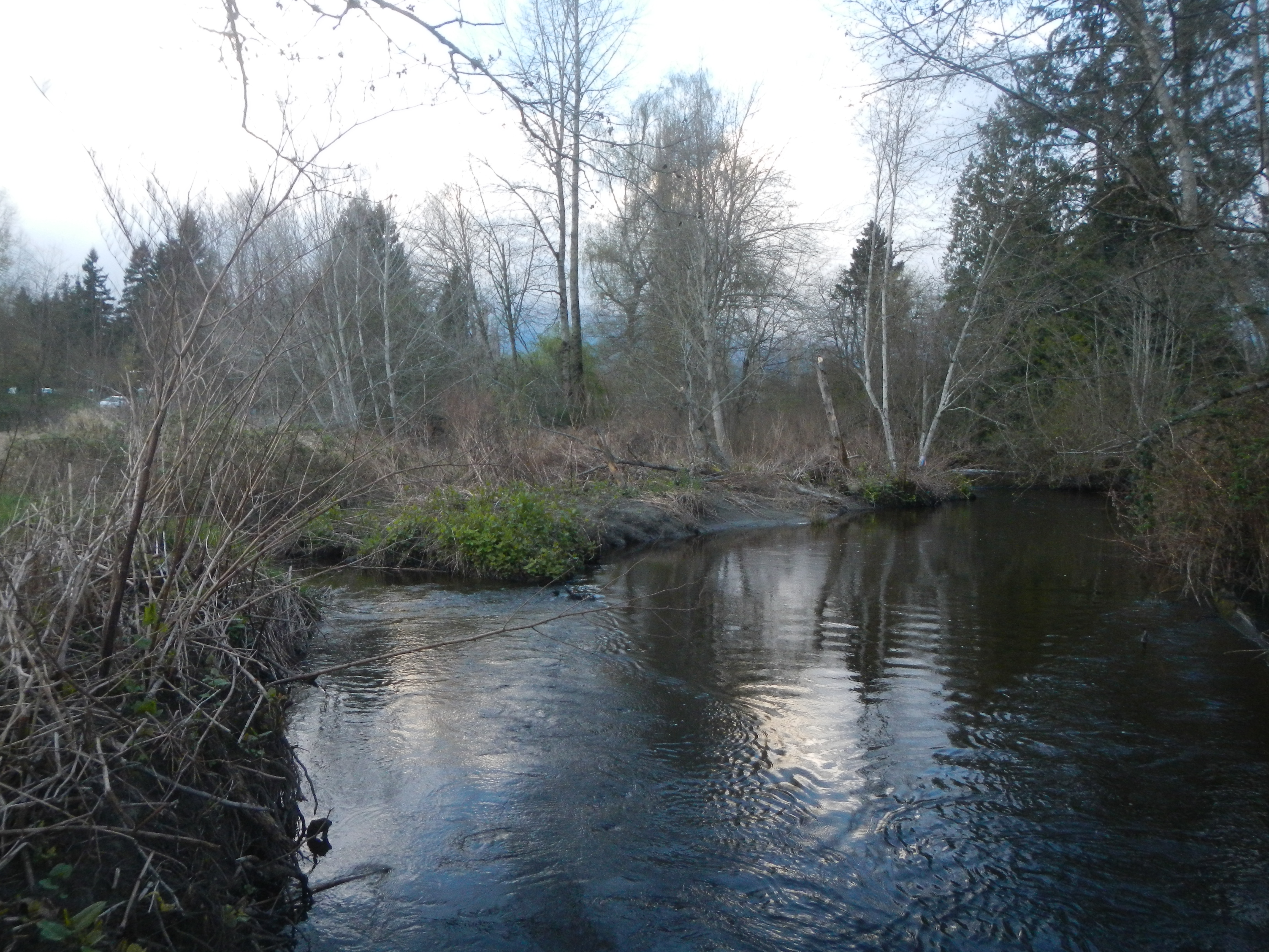
Attachment #218240, Bear Ck backwater Little Bit right bank2
King Co Water & Land Res; Lower Bear Creek Natural Area Additions (#15-1058) Attachment #218240, Bear Ck backwater Little Bit right bank2

King Co Water & Land Res; Lower Bear Creek Natural Area Additions (#15-1058)

Attachment #218240, Bear Ck backwater Little Bit right bank2 King Co Water & Land Res; Lower Bear Creek Natural Area Additions (#15-1058)

Attachment #218239, Bear Ck West Reid prop boundry
Project Status:  Closed Completed since 03/22/2019
 
Project Type:  Acquisition
Project Sponsor:  King County Water & Land Resources
Funding Board:  Salmon Recovery Funding Board
              Funding  
Puget Sound Acq. & Restoration: $356,993
Total RCO Grant: $356,993 (83%)
Sponsor Match: $71,416 (17%)
Total Agreement: $428,408 (100%)
              Links
 

    Project Description    
King County will use funds to acquire fee ownership of 2.8 acres one parcel adjacent to existing public ownership along the main stem of Bear Creek in unincorporated King County near the City of Redmond. The parcel proposed for acquisition will protect spawning and rearing habitat for Chinook salmon along 0.12 miles of stream and allow for future restoration to enhance riparian and in-stream habitat to benefit Chinook salmon.

    Project Contacts    
         
Project Sponsor: King County Water & Land Resources Lead Entity: Lake Washington/Cedar/Sammamish Watershed (WRIA 8) Lead Entity
  Project Contact: Denise Di Santo
ddisanto@kingcounty.gov
(206) 263-0259
   
 
Funding Agency: Recreation and Conservation Office    
  Project Manager: Sandy Dotts
sandra.dotts@rco.wa.gov
(360) 628-9487
   

    Project Location    
General Area:   Bear Creek
County:   King
Legislative District:   45
Legislative District:   48
Congressional District 2022:   08
Salmon Recovery Regions:   Puget Sound
Watershed Administrative Unit:   Sammamish River
HUC8:   Lake Washington (17110012)
WRIA:   Cedar - Sammamish
Sections:   06
Sections:   31
Township:   T25NR06E
Township:   T26NR06E
Coordinates:   47.68884247
-122.08876332

    Worksites    
Worksite NameScope of Work
Lower Bear Creek (#1) Administrative costs (Acq), Agency Indirect (Acq), Appraisal, Appraisal Review, Boundary line adjustment, Closing, Recording, Taxes, Title, Cultural resources (Acq), Easement, Environmental Audits, Land, Noxious weed control, Stewardship plan, Survey (Acq)
  
Amounts may not be complete

    Properties    
Worksite Name Property Name Actual Acquisition
Acres
Actual Acquisition
Cost
Lower Bear Creek (#1)   Property 1 - Private Landowner 5.60 $428,408
   Total5.60$428,408
Amounts may not be complete

    Project Milestones    
Milestone NameTarget DateDescription
Project Start 12/09/2015
Order Appraisal(s) 06/15/2016 Little Bit
Progress Report Due 06/30/2016
Order Appraisal Review(s) 08/30/2016 Little Bit
Annual Project Billing Due 12/31/2016
Progress Report Due 12/31/2016
Progress Report Due 06/30/2017
Purchase Agreement Signed 09/30/2017 Little Bit
Progress Report Due 12/31/2017
Annual Project Billing Due 12/31/2017
Acquisition Closing 06/08/2018 Little Bit
Progress Report Due 06/30/2018
Environmental Assess Complete 07/18/2018 Little Bit
Recorded Land Survey to RCO 07/18/2018 Little Bit
Stewardship Plan to RCO 08/31/2018 Little Bit
Final Report Due 09/30/2018
Recorded Acq Documents to RCO 09/30/2018 Little Bit
Agreement End Date 11/30/2018
Final Billing Due 11/30/2018


    Project Attachments    
Attachment TypeAttachment TitleAttach Date
Agreement - State 15-1058 Project Agreement.pdf 06/02/2016
Amendment - State 15-1058 Amend #2 Time Ext.pdf 08/13/2018
Amendment - State 15-1058 Amend #1 Scope Change.pdf 05/31/2018
Applicant Resolution/Authorizations 15-1058 Signature Authorization Resolution.pdf 03/08/2016
Applicant Resolution/Authorizations budget authorization resolution.pdf 03/04/2016
Applicant Resolution/Authorizations Authorization Resolution Bear Ck acq.pdf 03/04/2016
Application Review Report Application Review Report, 15-1058A(compl 08/21/15 15:39:07).pdf 08/21/2015
Deed WarrantyDeed-LittleBit.pdf.pdf 02/01/2019
Deed UnofficialWarrantyDeed-LittleBit.pdf.pdf 07/11/2018
Deed of right DOR Salmon Recovery.pdf 03/07/2019
Deed of right Little BitDOR.doc.doc 01/31/2019
Design document Little Bit WRIA 8 Tech Committee Presentation.pdf.pdf 06/10/2020
Easement Template_Conservation Easement_PAO approved.doc.doc 03/09/2017
Environmental Site Assessment Report EnviroAsses-LittleBit.pdf.pdf 07/11/2018
Final project report Final Report, 15-1058 (accepted 03/20/19 13:48:29).pdf 03/20/2019
Hazardous Substance Certification Form HazardousSubstancesCertification-LittleBit.pdf.pdf 07/20/2018
Inspection Report Inspection Report, #1736 (Accepted 03/14/19 14:12:06).pdf 03/14/2019
Map: Parcel map Little Bit Water Line Easement Location.pdf.pdf 01/30/2019
Map: Parcel map Union Hill Water Survey.pdf.pdf 01/30/2019
Map: Parcel map BearCreek_Detail_Aug06.pdf.pdf 08/08/2018
Map: Parcel map ParcelMap-LittleBit-Revised2018-08-02.pdf.pdf 08/03/2018
Map: Parcel map Map-LittleBit.pdf.pdf 07/11/2018
Map: Parcel map BearCreek_Aerials1936.pdf 08/13/2015
Map: Parcel map BearCreek_Aerials1977_1200.pdf 08/13/2015
Map: Parcel map BearCreek_Aerials1996_1200.pdf 08/13/2015
Map: Parcel map BearCreek_Aerials2000.pdf 08/13/2015
Map: Parcel map BearCreek_Aerials2002.pdf 08/13/2015
Map: Parcel map BearCreek_Aerials2005.pdf 08/13/2015
Map: Parcel map BearCreek_Aerials2010.pdf 08/13/2015
Map: Parcel map BearCreek_Aerials2013.pdf 08/13/2015
Map: Parcel map Reid_Detail.pdf 08/12/2015
Map: Parcel map Little_Bit_Detail.pdf 08/12/2015
Map: Parcel map BearCreek_FloodwayAndFloodplain.pdf 08/12/2015
Map: Parcel map BearCreek_Detail_Aug06.pdf 08/12/2015
Map: Parcel map BearCreek_Vicinity.pdf 03/27/2015
Photo IMG_0015.JPG.jpg 03/14/2019
Photo IMG_0014.JPG.jpg 03/14/2019
Photo IMG_0002.JPG.jpg 03/14/2019
Photo Lil bit signage installed 02-16-19.jpg 02/20/2019
Photo Bear Ck backwater Little Bit right bank2.jpg 04/02/2015
Photo Bear Ck West Reid prop boundry.jpg 04/02/2015
Progress report Progress Report, 15-1058 (accepted 06/14/18 15:30:44).pdf 06/14/2018
Progress report Progress Report, 15-1058 (accepted 12/11/17 12:19:54).pdf 12/11/2017
Progress report Progress Report, 15-1058 (accepted 10/12/17 16:14:50).pdf 10/12/2017
Progress report Progress Report, (accepted 03/10/17 09:15:28).pdf 03/10/2017
Progress report Progress Report 08/01/2016.pdf 08/01/2016
Project Application Report Application Report, 15-1058A (submitted 08/13/15 15:42:07).pdf 08/13/2015
Salmon Project Proposal Appendix_C_RestAcqCombProposal Lower Bear Ck Nat Area Add tr.docx 08/13/2015
SRFB Review Panel Comment Form 15-1058 Lower Bear Creek Natural Area Additions Comment Form.pdf 01/29/2016
Stewardship plan Lower-Bear-Creek-Natural-Area-Site-Management-Guidelines.pdf.pdf 02/01/2019
Stewardship plan Little Bit Stewardship Plan.doc.doc 12/20/2018
Survey-Property Boundary Little Bit BLA- RECORDED.pdf 08/08/2018
Visuals Final Inspection Photos.pptx 03/14/2019
Visuals 2015 Site Visit 15-1058 .pptx 05/08/2015

Back to top Date of last change: 06/30/2023