Peshastin RM 8.8 Side Channel Reconnection Design

05/21/2012, Attachment #151963, BRG Side Channel to Reconnect")
|
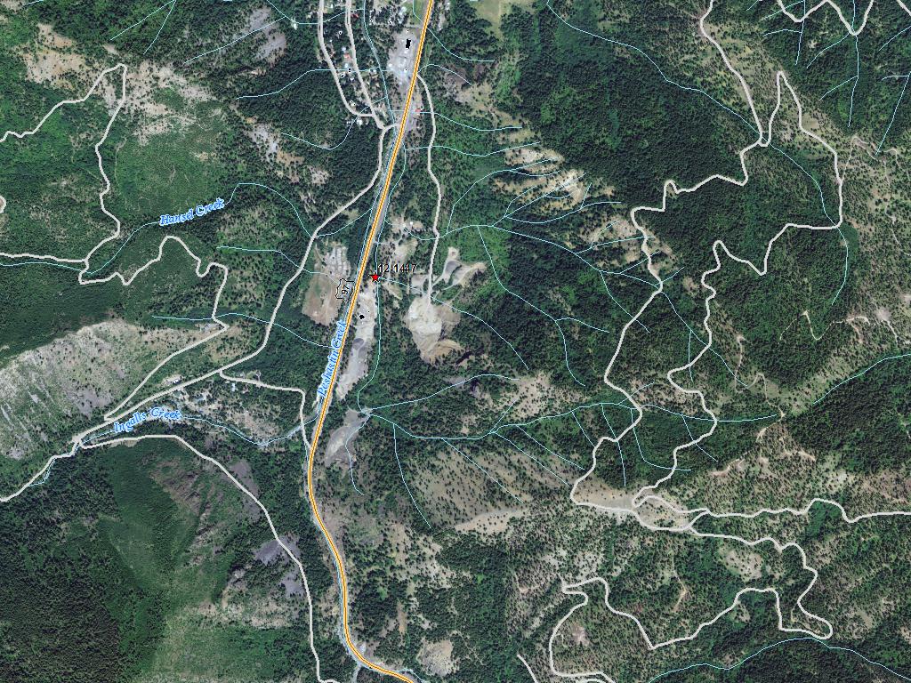
Chelan Co Natural Resource; Peshastin RM 8.8 Side Channel Reconnection Design (#12-1447)
05/21/2012, Attachment #151963, BRG Side Channel to Reconnect
|
|
|
|
|
|
The objective of the Peshastin Creek RM 8.8 Side Channel Reconnection Design project is to re-connect off-channel habitat and floodplain to provide rearing and refuge habitat for juvenile salmonids. The construction of SR 97 in 1956 disconnected 35 acres of floodplain and 4,300 linear feet of channel. In 2011-12 CCNRD conducted site assessments and landowner outreach to develop four conceptual reconnection alternatives. This proposal seeks conceptual design funds toassess the existing geomorphic and hydraulic processes to guide the selection and conceptual design of restoration efforts in Peshastin Creek. Due to the complexity of this site and the existing sediment transport load, a more thorough evaluation is warranted prior to advancing to the preliminary design stage. The CCNRD intends to work with the landowners and stakeholders to examine and select a preferred alternative. Peshastin Creek is a Category 2 watershed and contains Major spawning area for steelhead and minor spawning area for spring Chinook, and is a bull trout core area (UCRTT 2008). Within Peshastin Creek, the reconnection of floodplain and lengthening of the mainstem is a Biological Strategy Tier 1 action and top priority for addressing limiting habitat factors and the recovery and long-term viability of salmonids (UCRTT 2008, UCSRB 2007). The Peshastin Creek Tributary and Reach Assessment (TRA) (Interfluve 2010) identified the reconnection of the historical main channel at the RM 8.8R project site (BRG Site) as a priority habitat restoration project within Peshastin Creek.
|
|
General Area:
|
|
US 97, Leavenworth side of Blewett Pass, just upstream of Camas Creek
|
|
County:
|
|
Chelan
|
|
Legislative District:
|
|
12
|
|
Congressional District 2022:
|
|
08
|
|
Salmon Recovery Regions:
|
|
Upper Columbia River
|
|
Watershed Administrative Unit:
|
|
Mt Stuart
|
|
HUC8:
|
|
Wenatchee (17020011)
|
|
WRIA:
|
|
Wenatchee
|
|
Sections:
|
|
24
|
|
Township:
|
|
T23NR17E
|
|
Coordinates:
|
|
47.46900045
-120.65704122
|
|
|
| Worksite Name | Scope of Work | Actual Planning Cost |
|
Peshastin RM 8.8 side channel (#1)
|
Conducting habitat restoration scoping and feasibility studies (B.1.b.8)
|
$73,824
|
| | Total | $73,824 |
Amounts may not be complete
| Worksite Name | | Property Name | Landowner Type |
|
Peshastin RM 8.8 side channel (#1)
|
|
Property 1 - Peshastin Side Channel
|
Private
|
| | | | Total |
Amounts may not be complete
| Milestone Name | Target Date | Description |
|
Project Start
|
12/06/2012
|
|
|
RFP Complete/Consultant Hired
|
03/31/2015
|
|
|
Data Gathering Started
|
04/01/2015
|
|
|
Annual Project Billing Due
|
07/31/2015
|
|
|
Progress Report Due
|
07/31/2015
|
|
|
Agreement End Date
|
10/30/2015
|
|
|
Final Design to RCO
|
01/29/2016
|
Conceptual Design Deliverables, per Appendix D-1, Manual 18
|
|
Final Report Due
|
01/29/2016
|
|
|
Final Billing Due
|
01/29/2016
|
|
|
Special Conditions Met
|
01/29/2016
|
|