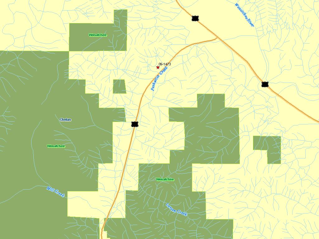
Peshastin Creek Reconnection Alternatives Analysis
The CCNRD proposes the Peshastin Creek Reconnection Alternatives Analysis to complete Alternatives Analysis and stakeholder coordination begin the largest channel reconnection project on Peshastin Creek. The US 97 highway grade has disconnected historic channel and floodplain habitat between RM 3.56 and RM 3.90. This project will lead to the reconnection of 2,400 linear feet of creek channel effectively lengthening the channel by 600 feet. The reduction in length at this site accounts for 14% of the total reduction in channel length attributed to construction of US 97. Peshastin Creek is a Category 2 watershed and contains Major spawning area for steelhead and minor spawning area for spring Chinook, and is a bull trout core area (UCRTT 2008). The restoration of ecosystem function through channel reconnection is a priority in Peshastin Creek (UCRTT 2009), and the completion of this project will addresses Tier 1 habitat restoration as recommended in the Biological Strategy (UCRTT 2008), and Recovery Plan (UCSRB 2007) for Peshastin Creek.
The CCNRD has been working with WSDOT to provide a long-term fix at the project site that benefits ESA-listed salmonids through full channel reconnection. The CCNRD will use data presented in the Yakama Nation Peshastin Creek Reach Assessment to develop and analyze design alternatives and complete 30% designs. The CCNRD work with WSDOT in 2010 to request funding for detailed engineering and design, permitting, and construction.
|
|
General Area:
|
|
3.5 miles south from the intersection of hwy 97 and 20
|
|
Waterbody:
|
|
Peshastin Creek, Wenatchee River
|
|
County:
|
|
Chelan
|
|
Legislative District:
|
|
12
|
|
Congressional District 2022:
|
|
08
|
|
Salmon Recovery Regions:
|
|
Upper Columbia River
|
|
Watershed Administrative Unit:
|
|
Mt Stuart
|
|
HUC8:
|
|
Wenatchee (17020011)
|
|
WRIA:
|
|
Wenatchee
|
|
Sections:
|
|
29
|
|
Township:
|
|
T24NR18E
|
|
Coordinates:
|
|
47.54933044
-120.61223889
|
|
|
Amounts may not be complete
| Worksite Name | | Property Name | Landowner Type |
|
Peshastin Creek Reconnection Alternative (#1)
|
|
Property 1 - Misc. private property owners and WSDOT
|
Private
|
| | | | Total |
Amounts may not be complete
| | Category / Work Type / Metric | Final |
Restoration Metrics (rolled up from Worksite level) |
|
| |
|
|
Area Encompassed (acres) (B.0.b.1)
|
8.6
|
| Milestone Name | Target Date | Description |
|
Project Start
|
12/10/2009
|
|
|
Progress Report Due
|
07/19/2010
|
|
|
Annual Project Billing Due
|
07/31/2010
|
|
|
Progress Report Due
|
12/01/2010
|
|
|
Bid Awarded/Consultant Hired
|
01/31/2011
|
|
|
Data Gathering Started
|
02/28/2011
|
|
|
Progress Report Due
|
07/01/2011
|
|
|
Annual Project Billing Due
|
07/31/2011
|
|
|
Draft Rpt Reviewed by Mgmt Agy
|
06/30/2012
|
|
|
Final Report Completed
|
08/31/2012
|
|
|
Agreement End Date
|
08/31/2012
|
|
|
Special Conditions Met
|
11/30/2012
|
design criteria outlined in special conditions of project agreement
|
|
Final Docs/Billing to Mgmt Agy
|
11/30/2012
|
|