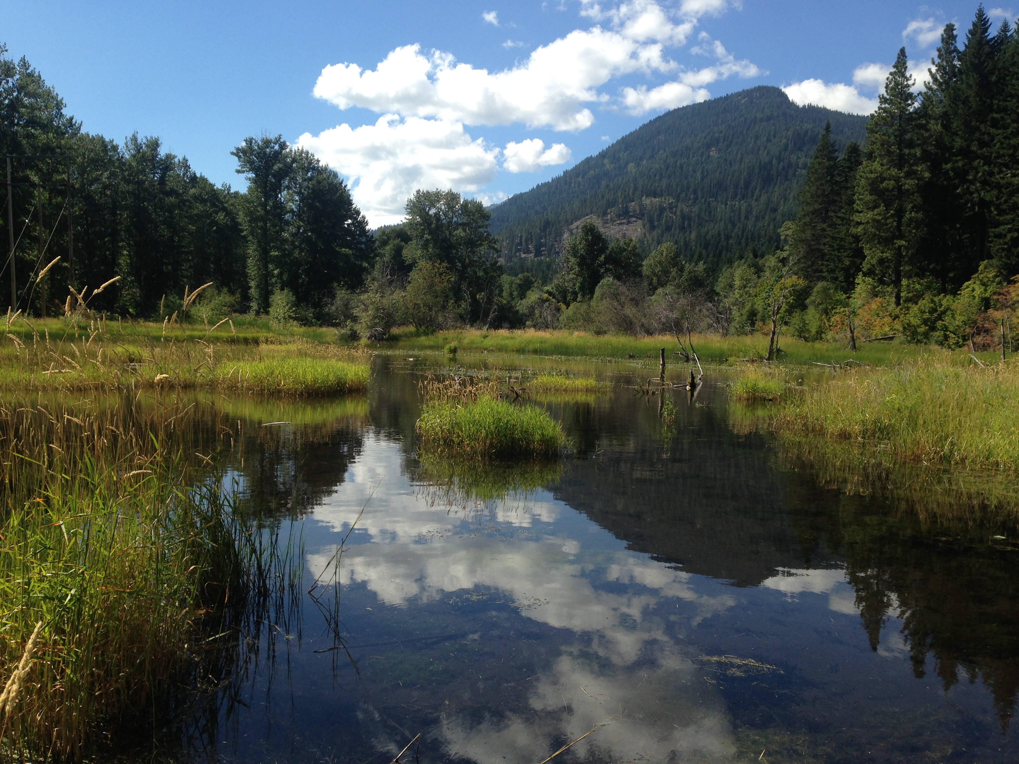
Upper White Pine Floodplain Reconnection

|
Chelan Co Natural Resource; Upper White Pine Floodplain Reconnection (#15-1210)
Attachment #220038, IMG_0244
|
|
|
|
|
|
This section of Nason Creek was re-located in the late 1950's when the BNSF railroad was built in it's current location. From RM 13.3 to RM 13.8, Nason Creek flows east between two constructed levees that protect the CPUD powerlines to the north and the BNSF railroad to the south. There is no spawning for spring Chinook or steelhead within the project area, however, spawning is present just upstream and downstream of the project area. The existing bed is incised due to channelization and Nason Creek is disconnected from the adjacent 30 acre floodplain wetland to the north. This project will remove ~0.5 mile of the river left levee, re-locate ~1,400 linear feet of straightened mainstem into a new meander alignment, provide over eight acres of floodplain rearing habitat, and re-connect ~30 acres of channel migration zone. This project will re-locate the CPUD powerlines out of the floodplain to accommodate stream restoration actions. The primary goal of the project is to improve and increase salmonid habitat in 0.5 mile of Nason Creek to increase the abundance and productivity of ESA-listed UCR spring Chinook salmon and UCR steelhead. This project will address the #1 ecological concern per the Biological Strategy by enhancing peripheral and transitional habitats in the #1 priority area in the Wenatchee Basin. This project will also address the #2 ecological concern in Nason Creek by improving in-stream complexity through the addition of large wood (332 pieces).
|
|
General Area:
|
|
Upper Nason Creek, upstream of Coles Corner
|
|
County:
|
|
Chelan
|
|
Legislative District:
|
|
12
|
|
Congressional District 2022:
|
|
08
|
|
Salmon Recovery Regions:
|
|
Upper Columbia River
|
|
Watershed Administrative Unit:
|
|
Upper Nason
|
|
HUC8:
|
|
Wenatchee (17020011)
|
|
WRIA:
|
|
Wenatchee
|
|
Sections:
|
|
05
|
|
Township:
|
|
T26NR16E
|
|
Coordinates:
|
|
47.78768261
-120.86621735
|
|
|
Amounts may not be complete
| Worksite Name | | Property Name | Landowner Type |
|
Nason Creek Upper White Pine (#1)
|
|
Property 1 - Nason Creek Upper White Pine
|
Federal Government
|
| | | | Total |
Amounts may not be complete
| | Category / Work Type / Metric | Final |
Restoration Metrics (rolled up from Worksite level) |
Instream Habitat Project |
| Channel reconfiguration and connectivity (C.4.c.1) |
|
|
Miles of Stream Treated for channel reconfiguration and connectivity (C.4.c.3)
|
0.50
|
|
|
Acres Of Channel/Off-Channel Connected Or Added (C.4.c.5)
|
27.0
|
|
|
Instream Pools Created/Added (C.4.c.6)
|
7
|
| Milestone Name | Target Date | Description |
|
Project Start
|
12/09/2015
|
|
|
Cultural Resources Complete
|
01/31/2016
|
NEPA too.
|
|
Landowner Agreement to RCO
|
07/31/2016
|
|
|
Progress Report Due
|
07/31/2016
|
|
|
Permits Complete
|
07/31/2016
|
|
|
Bid Awarded/Contractor Hired
|
07/31/2016
|
Phase 1 Tree Salvage
|
|
Preliminary Design to RCO
|
09/30/2016
|
|
|
Annual Project Billing Due
|
12/31/2016
|
|
|
Restoration Complete
|
12/31/2016
|
Phase 1 Tree Salvage Complete
|
|
Progress Report Due
|
12/31/2016
|
|
|
Final Design to RCO
|
02/28/2017
|
Stream Restoration, as described in RCO Manual #18, Appendix D-3.
|
|
Restoration Started
|
07/31/2017
|
Phase 2 Stream Restoration Channel Construction
|
|
Progress Report Due
|
07/31/2017
|
|
|
Restoration Complete
|
07/31/2017
|
Phase 1 Powerline Re-location
|
|
Annual Project Billing Due
|
12/31/2017
|
|
|
Progress Report Due
|
12/31/2017
|
|
|
Restoration Complete
|
12/31/2017
|
Phase 2 Stream Restortion Channel Construction
|
|
Final Design to RCO
|
12/31/2017
|
As-built Design for Phase 2 Restoration, as described in RCO Manual #18, Appendix D-4.
|
|
Progress Report Due
|
07/31/2018
|
|
|
RCO Final Inspection
|
10/29/2018
|
|
|
Agreement End Date
|
12/31/2018
|
|
|
Annual Project Billing Due
|
12/31/2018
|
|
|
Restoration Complete
|
12/31/2018
|
Phase 3 Levee Removal, Flow Diversion to New Channel and Mainstem Backfill
|
|
Final Report Due
|
03/31/2019
|
|
|
Final Billing Due
|
03/31/2019
|
|