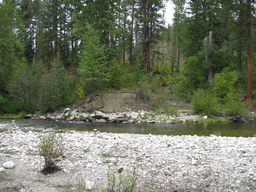
Lower Nason Creek RM 3.7 - 4.7 Restoration

|
Chelan Co Natural Resource; Lower Nason Creek RM 3.7 - 4.7 Restoration (#12-1438)
Attachment #149996, Bridge_Abuttment_Fill_removal
|
|
|
|
|
The goals of the Lower Nason Creek RM 3.7-4.7 restoration project are to improve rearing habitat for juvenile steelhead and spring Chinook salmon and to increase Chinook spawning habitat. These goals will be met through implementation of the following objectives:
1. Remove floodplain fill (~0.64 acres) and increase activation of existing side channels to increase floodplain connectivity;
2. Increase habitat complexity, through habitat enhancement, in the existing oxbow
3. Preliminary design and permitting of floodplain side channel reconnection near RM 4.6.
SR 207 has disconnected Nason Creek from 77 acres of adjacent floodplain habitat. Nason Creek, a tributary to the Wenatchee River, is a Category 2 Watershed that contains spawning, rearing, and migration habitat for spring Chinook salmon, bull trout, and steelhead. CCNRD evaluated the feasibility of re-locating SR 207 out of the floodplain. However, SR 207 relocation would cost 10-20+ million and there may not be that level of funding available. This proposal identifies three different actions that could be implemented to improve in-stream conditions in this reach.
|
|
General Area:
|
|
Downstream of Cole's Corner
|
|
County:
|
|
Chelan
|
|
Legislative District:
|
|
12
|
|
Congressional District 2022:
|
|
08
|
|
Salmon Recovery Regions:
|
|
Upper Columbia River
|
|
Watershed Administrative Unit:
|
|
Lower Nason
|
|
HUC8:
|
|
Wenatchee (17020011)
|
|
WRIA:
|
|
Wenatchee
|
|
Sections:
|
|
09
|
|
Township:
|
|
T26NR17E
|
|
Coordinates:
|
|
47.76109265
-120.73591185
|
|
|
| Worksite Name | Scope of Work | Actual Planning and Restoration Cost |
|
Fill Removal, Oxbow Enhance & Design (#1)
|
Architectural & Engineering (A&E), Channel reconfiguration and connectivity (C.4.c.1), Channel structure placement (C.4.d.1), Cultural resources, Final design and permitting (B.1.b.11.a RCO), Implementation monitoring, Obtain permits
|
$402,982
|
| | Total | $402,982 |
Amounts may not be complete
| Worksite Name | | Property Name | Landowner Type |
|
Fill Removal, Oxbow Enhance & Design (#1)
|
|
Property 1 - Weyerhaeuser - Columbia Timberlands
|
Private
|
|
Fill Removal, Oxbow Enhance & Design (#1)
|
|
Property 2 - USFS
|
Federal Government
|
| | | | Total |
Amounts may not be complete
| | Category / Work Type / Metric | Final |
Restoration Metrics (rolled up from Worksite level) |
|
| |
|
|
Area Encompassed (acres) (B.0.b.1)
|
3.5
|
Instream Habitat Project |
| Channel reconfiguration and connectivity (C.4.c.1) |
|
|
Miles of Stream Treated for channel reconfiguration and connectivity (C.4.c.3)
|
0.01
|
|
|
Miles of Off-Channel Stream Created or Connected (C.4.c.4)
|
0.04
|
|
|
Acres Of Channel/Off-Channel Connected Or Added (C.4.c.5)
|
0.6
|
| Channel structure placement (C.4.d.1) |
|
|
Miles of Stream Treated for channel structure placement (C.4.d.3)
|
0.50
|
|
|
Pools Created through channel structure placement (C.4.d.5)
|
4
|
|
|
Number of structures placed in channel (C.4.d.7)
|
4
|
Permits |
| Obtain permits |
|
|
Number of permits required for implementation of project
|
5
|
|
| |
|
|
Miles of Stream and/or Shoreline Affected (B.0.b.2)
|
0.50
|
| Milestone Name | Target Date | Description |
|
Project Start
|
12/06/2012
|
|
|
Annual Project Billing Due
|
07/31/2013
|
|
|
Progress Report Due
|
07/31/2013
|
|
|
Preliminary Design to RCO
|
09/01/2013
|
|
|
Applied for Permits
|
12/31/2013
|
For Objectives #1 (Removal of Floodplain fill) & #2 (Oxbow Enhancement)
|
|
Special Conditions Met
|
01/31/2014
|
SRFB review panel requires 30-day review period of preliminary design. Chelan County cannot proceed to final design or construction phase until preliminary design is approved.
|
|
Progress Report Due
|
01/31/2014
|
|
|
Landowner Agreement to RCO
|
02/28/2014
|
|
|
Cultural Resources Complete
|
06/01/2014
|
|
|
Permits Complete
|
06/30/2014
|
For Objectives #1 (Removal of Floodplain fill) & #2 (Oxbow Enhancement)
|
|
Bid Awarded/Contractor Hired
|
07/15/2014
|
|
|
Annual Project Billing Due
|
07/31/2014
|
|
|
Progress Report Due
|
07/31/2014
|
|
|
Restoration Started
|
08/01/2014
|
|
|
Final Design to RCO
|
08/01/2014
|
|
|
RCO Final Inspection
|
11/24/2014
|
|
|
Progress Report Due
|
01/31/2015
|
|
|
Annual Project Billing Due
|
07/31/2015
|
|
|
Progress Report Due
|
07/31/2015
|
|
|
Progress Report Due
|
01/31/2016
|
|
|
Annual Project Billing Due
|
07/31/2016
|
|
|
Progress Report Due
|
07/31/2016
|
|
|
Applied for Permits
|
12/30/2016
|
For Objective #3 (Side Channel Reconnection)
|
|
Permits Complete
|
12/30/2016
|
For Objective #3 (Side Channel Reconnection)
|
|
Restoration Complete
|
12/31/2016
|
Includes post project implementation monitoring and adaptive management, as needed.
|
|
Agreement End Date
|
12/31/2016
|
|
|
Final Report Due
|
03/15/2017
|
|
|
Final Billing Due
|
03/15/2017
|
|