Tepee Creek Restoration - Phase 2 Construction

Attachment #77250, Tepee Ck Restoration - Phase 2 Existing Conditions")
|
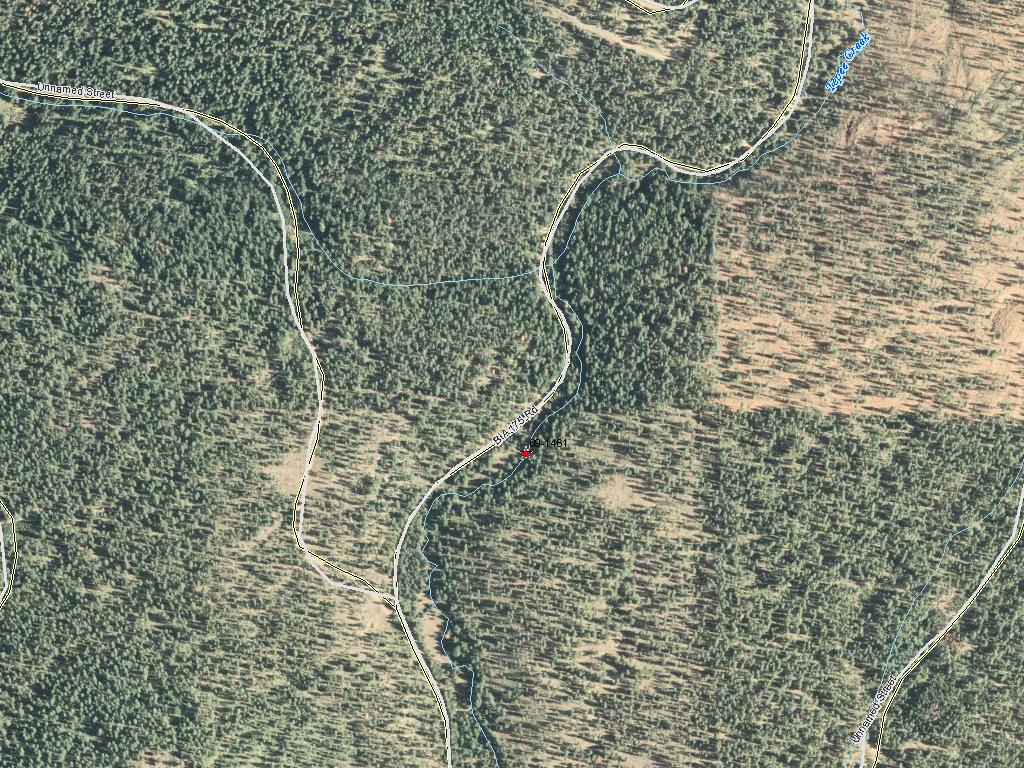
Yakama Nation; Tepee Creek Restoration - Phase 2 Construction (#09-1461)
Attachment #77250, Tepee Ck Restoration - Phase 2 Existing Conditions
|
|
|
|
|
Tepee Creek, a tributary to White Creek in the Klickitat River subbasin, provides important spawning and rearing habitat for ESA-listed Middle Columbia River steelhead. The White Creek watershed as a whole is the most important steelhead spawning and rearing tributary watershed within the Klickitat subbasin, accounting for up to 40% of the observed steelhead spawning in the entire Klickitat subbasin in some years. Tepee Creek has accounted for up to 21% of the observed spawning in the Klickitat subbasin in recent years, however in most years it likely accounts for between 5 and 10%. Extensive reaches of Tepee Creek have become incised and are now intermittent in many places that anecdotal evidence suggests were once perennial. Flood plain connectivity will be reestablished between river miles 4.5 to 5.3 with the ultimate goal of increasing floodplain storage, reducing severity of active channel hydraulic conditions during high flows, enhancing instream habitat, and potentially restoring baseflows to this and downstream reaches. In order to restore overbank flow frequency to the pre-disturbance floodplain, gravels will be imported and pool-riffle sequences will be constructed. In addition, LWD jams will be constructed along channel margins to maintain pool depths, provide cover, and restrict bank erosion. The approach to be used has been successfully implemented as part the Tepee Creek - IXL Meadows Restoration Project (constructed in 2006 and 2007).
Project timeline: July 15, 2010 - November 15, 2011
|
|
General Area:
|
|
Tepee Creek, tributary of the Klickitat River
|
|
Waterbody:
|
|
Tepee Creek, White Creek
|
|
County:
|
|
Yakima
|
|
Legislative District:
|
|
14
|
|
Congressional District 2022:
|
|
04
|
|
Salmon Recovery Regions:
|
|
Middle Columbia River
|
|
Watershed Administrative Unit:
|
|
Tepee Creek
|
|
HUC8:
|
|
Klickitat (17070106)
|
|
WRIA:
|
|
Klickitat
|
|
Sections:
|
|
22
|
|
Township:
|
|
T08NR14E
|
|
Coordinates:
|
|
46.17266156
-121.03271221
|
|
|
| Worksite Name | Scope of Work | Actual Restoration Cost |
|
RM 4.5-5.3 (#1)
|
Architectural & Engineering (A&E), Channel reconfiguration and connectivity (C.4.c.1), Channel structure placement (C.4.d.1), Fencing (C.5.d.1), Obtain permits, Riparian Plant removal / control (C.5.h.1), Streambank stabilization (C.4.e.1)
|
$504,116
|
| | Total | $504,116 |
Amounts may not be complete
| Worksite Name | | Property Name | Landowner Type |
|
RM 4.5-5.3 (#1)
|
|
Property 1 - Tepee Creek
|
Tribal Government
|
| | | | Total |
Amounts may not be complete
| | Category / Work Type / Metric | Final |
Restoration Metrics (rolled up from Worksite level) |
Instream Habitat Project |
| Channel reconfiguration and connectivity (C.4.c.1) |
|
|
Miles of Stream Treated for channel reconfiguration and connectivity (C.4.c.3)
|
0.70
|
|
|
Miles of Off-Channel Stream Created or Connected (C.4.c.4)
|
0.03
|
|
|
Acres Of Channel/Off-Channel Connected Or Added (C.4.c.5)
|
1.0
|
|
|
Instream Pools Created/Added (C.4.c.6)
|
26
|
| Channel structure placement (C.4.d.1) |
|
|
Miles of Stream Treated for channel structure placement (C.4.d.3)
|
0.70
|
|
|
Acres Of Streambed Treated for channel structure placement (C.4.d.4)
|
0.4
|
|
|
Pools Created through channel structure placement (C.4.d.5)
|
26
|
|
|
Number of structures placed in channel (C.4.d.7)
|
26
|
| Streambank stabilization (C.4.e.1) |
|
|
Miles of Streambank Stabilized (C.4.e.3)
|
0.70
|
Riparian Habitat Project |
| Fencing (C.5.d.1) |
|
|
Miles of Fence Along Stream (C.5.d.2)
|
1.60
|
|
|
Acres of Riparian Area Protected by fencing (C.5.d.3)
|
4.0
|
| Riparian Plant removal / control (C.5.h.1) |
|
|
Acres of riparian treated for plant removal/control (C.5.h.3)
|
4.0
|
Permits |
| Obtain permits |
|
|
Number of permits required for implementation of project
|
3
|
| Milestone Name | Target Date | Description |
|
Project Start
|
12/10/2009
|
|
|
Annual Project Billing Due
|
07/31/2010
|
|
|
Cultural Resources Complete
|
12/10/2010
|
Already completed
|
|
Progress Report Due
|
12/30/2010
|
|
|
Progress Report Due
|
06/30/2011
|
|
|
Annual Project Billing Due
|
07/31/2011
|
|
|
Construction Started
|
10/17/2011
|
originally 9/9/2010
|
|
Progress Report Due
|
12/31/2011
|
|
|
Progress Report Due
|
06/30/2012
|
|
|
Annual Project Billing Due
|
07/31/2012
|
|
|
Progress Report Due
|
12/30/2012
|
|
|
Progress Report Due
|
05/31/2013
|
|
|
Annual Project Billing Due
|
07/31/2013
|
|
|
Progress Report Due
|
11/18/2013
|
|
|
Construction Complete
|
12/16/2013
|
|
|
Agreement End Date
|
03/01/2014
|
|
|
Final Docs/Billing to Mgmt Agy
|
05/01/2014
|
|