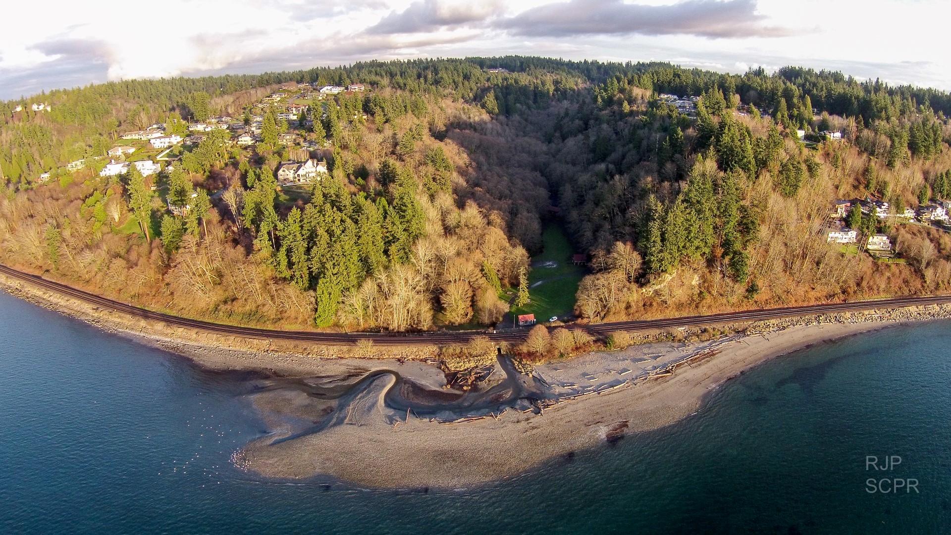
Meadowdale Beach Park & Estuary Restoration Design

|
Snohomish County Parks Dept; Meadowdale Beach Park & Estuary Restoration Design (#15-1056)
Attachment #217842, Aerial View 12-2-14
|
|
|
|
|
|
Snohomish County will use this grant to prepare preliminary design deliverables for habitat improvements at Meadowdale Beach County Park at the northern end of Browns Bay in Puget Sound. Located within a portion of the City of Edmonds and unincorporated Snohomish County, the site is south of Mulkilteo and abuts City of Lynnwood Park preserved property to the east. The project improvements are focused on enhancing rearing habitat for non-natal juvenile Chinook (threatened), Coho, and Chum salmon; Cutthroat Trout and other fish species. The design entails removing approximately 130 linear feet of hard armored railroad embankment and the under-sized culvert (6' wide) for Lund’s Gulch Creek, installing a four-span bridge, creating up to nearly one acre of tidal marsh pocket estuary, connecting a small freshwater wetland to the creek, restoring approximately one acre of nearshore and stream riparian buffers along 1050' of shoreline, and restoring sediment delivery that will support approximatlely one acre of delta formation. The bridge opening will dissipate flood waters and will enable a widened creek meander that will be dynamic over time creating essential habitat.
|
|
General Area:
|
|
Lund Creek, Puget Sound
|
|
County:
|
|
Snohomish
|
|
Legislative District:
|
|
21
|
|
Congressional District 2022:
|
|
02
|
|
Salmon Recovery Regions:
|
|
Puget Sound
|
|
Watershed Administrative Unit:
|
|
Possession Sound-N Elliot Bay
|
|
HUC8:
|
|
Puget Sound (17110019)
|
|
WRIA:
|
|
Cedar - Sammamish
|
|
Sections:
|
|
05
|
|
Township:
|
|
T27NR04E
|
|
Coordinates:
|
|
47.85989245
-122.33476337
|
|
|
Amounts may not be complete
| Worksite Name | | Property Name | Landowner Type |
|
Meadowdale Beach County Park (#1)
|
|
Property 1 - Meadowdale Beach Park
|
Local Government
|
|
Meadowdale Beach County Park (#1)
|
|
Property 2 - BNSF Railroad Right of Way
|
Private
|
| | | | Total |
Amounts may not be complete
| | Category / Work Type / Metric | Final |
Restoration Metrics (rolled up from Worksite level) |
|
| |
|
|
Area Encompassed (acres) (B.0.b.1)
|
10.0
|
|
|
Miles of Stream and/or Shoreline Affected (B.0.b.2)
|
0.20
|
| Milestone Name | Target Date | Description |
|
Project Start
|
12/09/2015
|
|
|
Progress Report Due
|
05/30/2016
|
|
|
RFP Complete/Consultant Hired
|
07/08/2016
|
|
|
Data Gathering Started
|
07/18/2016
|
|
|
Progress Report Due
|
11/30/2016
|
|
|
Annual Project Billing Due
|
02/16/2017
|
|
|
Progress Report Due
|
05/30/2017
|
|
|
Annual Project Billing Due
|
07/31/2017
|
|
|
Cultural Resources Complete
|
09/29/2017
|
Prior to ground disturbance (geo-tech)
|
|
Progress Report Due
|
11/30/2017
|
|
|
Preliminary Design to RCO
|
01/11/2018
|
|
|
Agreement End Date
|
02/26/2018
|
|
|
Final Report Due
|
03/31/2018
|
|
|
Final Billing Due
|
03/31/2018
|
|