Okanogan River System Thermal Imaging

|
Colville Confederated Tribes; Okanogan River System Thermal Imaging (#01-1390)
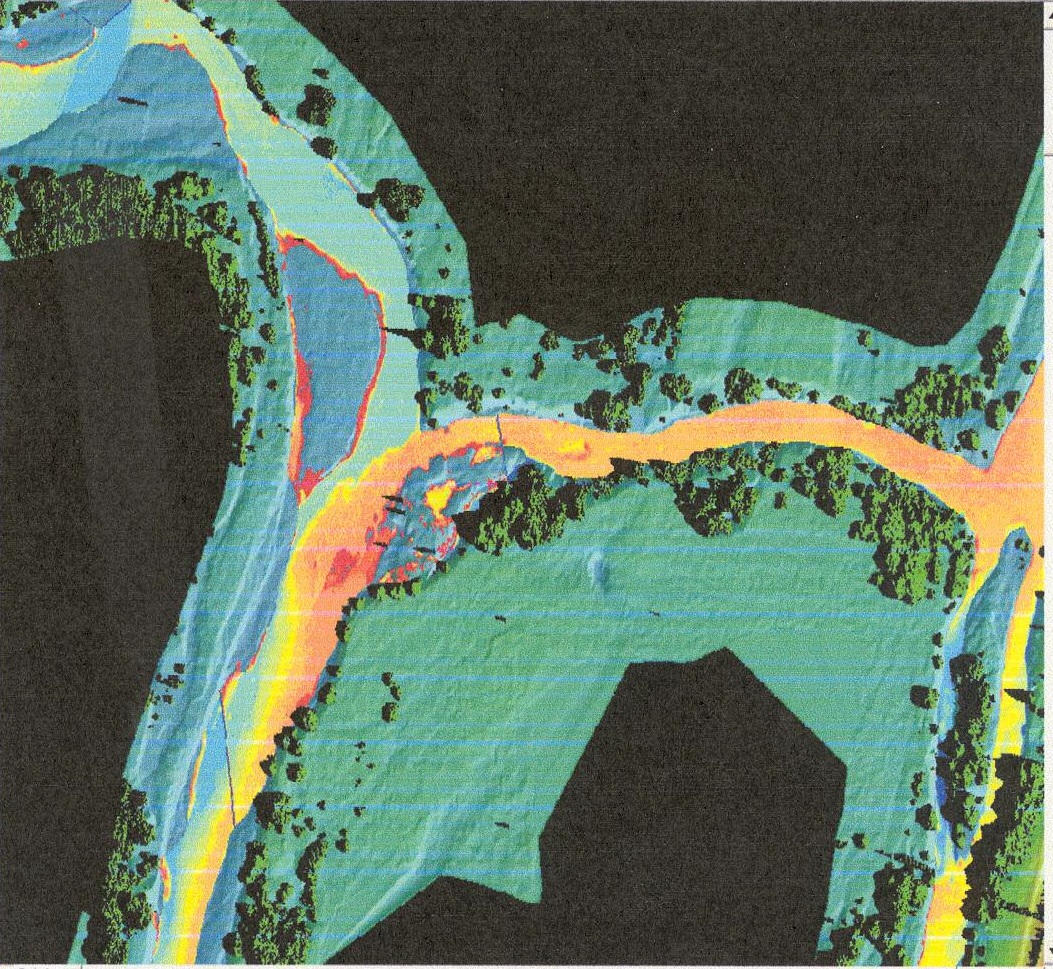
Attachment #154796, sample thermal image
|
|
|
|
|
The Okanogan River (WRIA 48) system is currently listed as a 303(d) stream due to water temperature exceedances. The Okanogan is inhabited by steelhead (ESA Endangered), bull trout (ESA Threatened), sockeye, and summer/fall chinook. Spring Chinook and Coho are considered to be extirpated from the basin.
The Limiting Factors Analysis (SRFB) and the Okanogan Subbasin Summary (NWPPC) both list water temperatures as a factor limiting salmonid production. Determination of thermal input sources is a necessary precursor to corrective action.
This project will employ Forward Looking Infra-Red (FLIR) thermal imaging technology to collect water temperature information which, along with densiometry, riparian vegetation, stream flow, climate, and stream channel width-to-depth ratio data, will be incorporated into a Stream Segment Temperature Model (SSTEMP) to assess thermal input sources and potential corrective measures.
This project will include in-kind cost sharing and participation with a coordinated group of state, federal, and tribal entities.
|
|
General Area:
|
|
Okanogan River & Columbia River confluence upstream (north) to River Mile 125 near the Canadian border.
|
|
Waterbody:
|
|
Columbia River, Okanogan River, Osoyoos Lake
|
|
County:
|
|
Okanogan
|
|
Legislative District:
|
|
07
|
|
Congressional District 2022:
|
|
04
|
|
Salmon Recovery Regions:
|
|
Upper Columbia River
|
|
Watershed Administrative Unit:
|
|
Lower Okanogan River
|
|
Watershed Administrative Unit:
|
|
Similkameen River
|
|
HUC8:
|
|
Chief Joseph (17020005)
|
|
HUC8:
|
|
Okanogan (17020006)
|
|
HUC8:
|
|
Similkameen (17020007)
|
|
WRIA:
|
|
Okanogan
|
|
Sections:
|
|
04
|
|
Sections:
|
|
09
|
|
Sections:
|
|
18
|
|
Sections:
|
|
28
|
|
Township:
|
|
T30NR25E
|
|
Township:
|
|
T40NR27E
|
|
Coordinates:
|
|
48.10731590
-119.69446087
|
|
|
Amounts may not be complete
| | Category / Work Type / Metric | Final |
Restoration Metrics (rolled up from Worksite level) |
|
| |
|
|
Area Encompassed (acres) (B.0.b.1)
|
2000.0
|
Salmonid Habitat Assessment / Inventory |
| Habitat surveys (B.2.d) |
|
|
Acres of habitat assessed (B.2.d.2)
|
2000.0
|
| Milestone Name | Target Date | Description |
|
Project Start
|
05/01/2002
|
|
|
RFP Complete
|
08/01/2003
|
already awarded
|
|
Bid Awarded/Consultant Hired
|
08/10/2003
|
|
|
Data Gathering Started
|
08/15/2003
|
thermal imagery started, Phase I and II data acquisition
|
|
Draft Rpt Reviewed by Mgmt Agy
|
10/31/2003
|
imagery files completed and delivered, Phase I
|
|
Final Report Completed
|
06/30/2004
|
|
|
Agreement End Date
|
07/31/2004
|
|
|
Final Docs/Billing to Mgmt Agy
|
10/30/2004
|
|