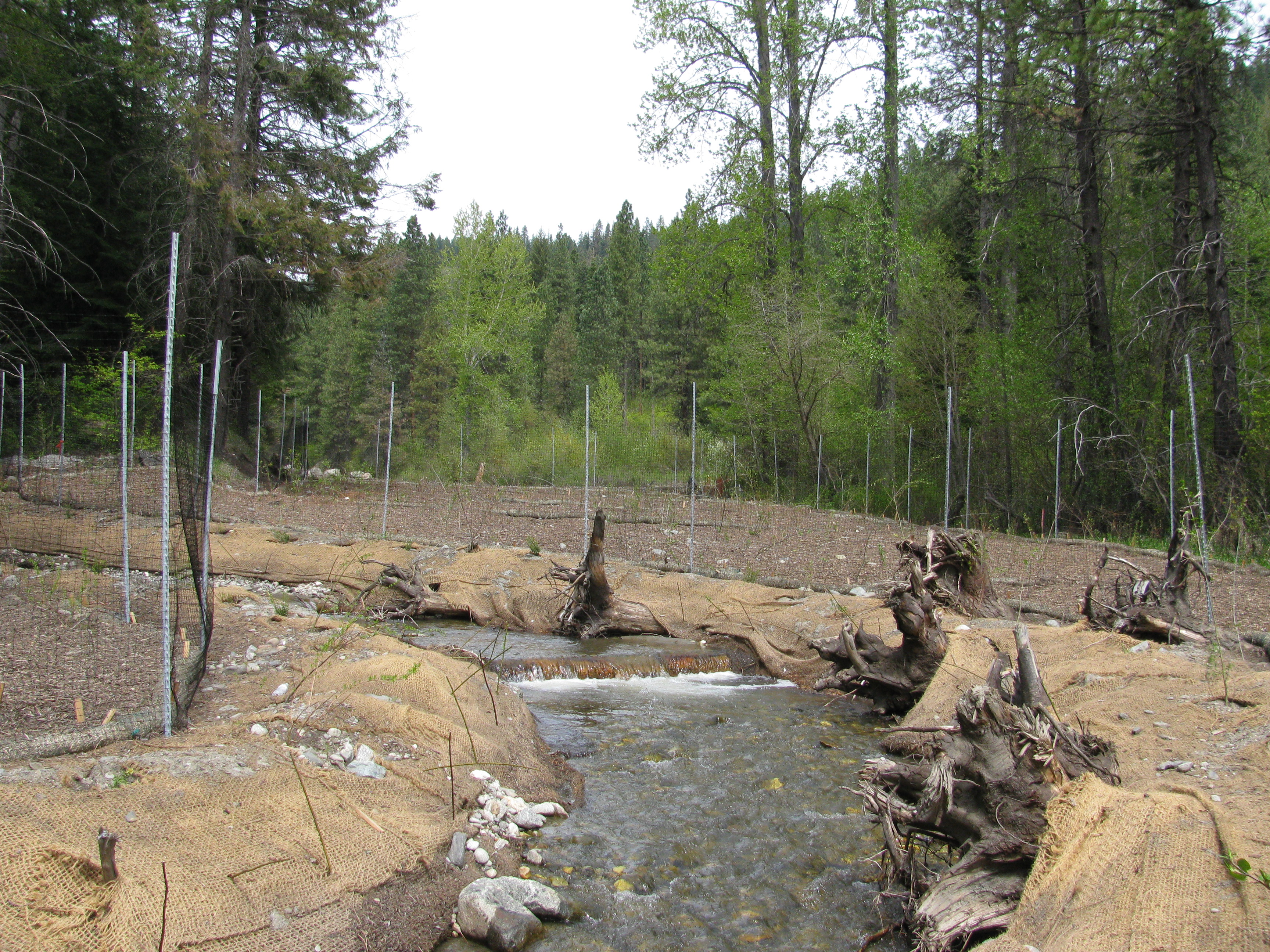
Skinney Creek Floodplain Restoration Design

|
Chelan Co Natural Resource; Skinney Creek Floodplain Restoration Design (#14-1732)
Attachment #202104, IMG_2788
|
|
|
|
|
The project proposes to develop prelminary designs for a Skinney Creek restoration project. Railroad construction and subsequent construction of Highway 2 re-aligned Skinney Creek into its current channel configuration. The lower 2,000 feet of Skinney Creek is narrow and confined between two remnant berms or levees. The proposed design project will re-construct the stream channel into its former floodplain area.
The primary habitat-limiting factors within Skinney Creek are artificial obstructions, riparian condition, channel entrenchment, water quality (fine sediment), off-channel habitat, and large woody debris. All the fish passage barriers have been removed from Skinney Creek. However, highway and railroad construction have impacted stream processes such as hydro-geomorphic processes, woody debris recruitment, channel migration, instream habitat complexity, and gravel recruitment. Today, Skinney Creek within the project area is characterized by an entrenched channel with little habitat complexity, a lack of large wood and pools, and no floodplain access due to the levees that border the channel.
Skinney Creek does provide habitat for spring Chinook and steelhead. However, there is likely limited use by both species under current conditions. The project goal is to restore natural stream processes such as stream channel function, channel complexity, and floodplain connectivity. This will increase habitat diversity and improve rearing and spawning potential in Skinney Creek for spring Chinook and steelhead.
|
|
General Area:
|
|
Upstream end of Tumwater Canyon
|
|
County:
|
|
Chelan
|
|
Legislative District:
|
|
12
|
|
Congressional District 2022:
|
|
08
|
|
Salmon Recovery Regions:
|
|
Upper Columbia River
|
|
Watershed Administrative Unit:
|
|
Chiwaukum
|
|
HUC8:
|
|
Wenatchee (17020011)
|
|
WRIA:
|
|
Wenatchee
|
|
Sections:
|
|
04
|
|
Township:
|
|
T25NR17E
|
|
Coordinates:
|
|
47.68929463
-120.73672633
|
|
|
Amounts may not be complete
| Worksite Name | | Property Name | Landowner Type |
|
Skinney Creek Floodplain (#1)
|
|
Property 1 - Skinney Creek Floodplain
|
Federal Government
|
| | | | Total |
Amounts may not be complete
| | Category / Work Type / Metric | Final |
Restoration Metrics (rolled up from Worksite level) |
|
| |
|
|
Area Encompassed (acres) (B.0.b.1)
|
10.0
|
|
|
Miles of Stream and/or Shoreline Affected (B.0.b.2)
|
0.70
|
| Milestone Name | Target Date | Description |
|
Project Start
|
11/25/2015
|
|
|
Data Gathering Started
|
01/31/2016
|
|
|
Progress Report Due
|
06/30/2016
|
|
|
RFP Complete/Consultant Hired
|
07/31/2016
|
|
|
Annual Project Billing Due
|
07/31/2016
|
|
|
Progress Report Due
|
12/31/2016
|
|
|
Data Gathering Started
|
12/31/2016
|
Topographic survey
|
|
Draft Design to RCO
|
06/30/2017
|
Conceptual Design
|
|
Progress Report Due
|
06/30/2017
|
|
|
Annual Project Billing Due
|
07/31/2017
|
|
|
Preliminary Design to RCO
|
12/31/2017
|
|
|
Special Conditions Met
|
12/31/2017
|
M18, Appendix D-2, Prelminary Design Deliverables, pages 115-120
|
|
Cultural Resources Complete
|
12/31/2017
|
|
|
Agreement End Date
|
01/31/2018
|
|
|
Final Report Due
|
03/31/2018
|
|
|
Final Billing Due
|
03/31/2018
|
|