Final Design and Permitting for Nason Creek N1
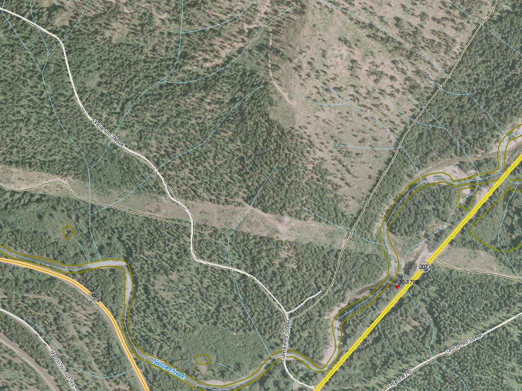
The Chelan County Natural Resources Department (CCNRD) is seeking funds for the final design and permitting for the Nason Creek N1 Floodplain Reconnection project. This project will reconnect Nason Creek to a disconnected floodplain area that is located just downstream from Coles Corner near State Route 207. Construction of SR 207 in the 1950’s disconnected Nason Creek from 8.7 acres of floodplain and forced the river to make a 90 degree turn against the road prism at the location of a possible inlet to the disconnected floodplain area. The Wenatchee Watershed Planning Unit Habitat Subcommittee has identified this disconnected floodplain (N1) as a priority reconnection opportunity within the Nason Creek Kahler Reach Assessment recently completed by the United States Bureau of Reclamation (USBR 2009). Floodplain reconnection will address limiting factors for endangered spring Chinook, endangered steelhead and threatened bull trout by improving floodplain function. CCNRD is currently evaluating reach scale alternatives to a draft design proposed by WSDOT to install riprap and rock barbs to the State Route 207 road prism in the vicinity of the 90 degree turn. If the final design and permitting are funded, CCNRD will be able to work with WSDOT to seek funds for construction of a more fish friendly alternative to the rip rap proposed. This project has not been previously reviewed by SRFB.
|
|
General Area:
|
|
Chelan County
|
|
County:
|
|
Chelan
|
|
Legislative District:
|
|
12
|
|
Congressional District 2022:
|
|
08
|
|
Salmon Recovery Regions:
|
|
Upper Columbia River
|
|
Watershed Administrative Unit:
|
|
Lower Nason
|
|
HUC8:
|
|
Wenatchee (17020011)
|
|
WRIA:
|
|
Wenatchee
|
|
Sections:
|
|
09
|
|
Township:
|
|
T26NR17E
|
|
Coordinates:
|
|
47.76303492
-120.73142861
|
|
|
| Worksite Name | Scope of Work | Proposed Planning Cost |
|
N1 Floodplain Reconnection (#1)
|
Cultural resources, Final design and permitting (B.1.b.11.a RCO), Preliminary design (B.1.b.11.a RCO)
|
$222,279
|
| | Total | $222,279 |
Amounts may not be complete
| Worksite Name | | Property Name | Landowner Type |
|
N1 Floodplain Reconnection (#1)
|
|
Property 1 - 26N17E9 Tax lot 310050
|
Private
|
|
N1 Floodplain Reconnection (#1)
|
|
Property 2 - 26N17E9
|
Federal Government
|
| | | | Total |
Amounts may not be complete
| | Category / Work Type / Metric | Estimated |
Restoration Metrics (rolled up from Worksite level) |
|
| |
|
|
Area Encompassed (acres) (B.0.b.1)
|
10.0
|
| Milestone Name | Target Date | Description |
|
Project Start
|
|
|
|
RFP Complete
|
|
|
|
Bid Awarded/Consultant Hired
|
|
|
|
Cultural Resources Complete
|
|
|
|
Data Gathering Started
|
|
|
|
Draft Rpt Reviewed by Mgmt Agy
|
|
|
|
Special Conditions Met
|
|
|
|
Annual Project Billing Due
|
|
|
|
Progress Report Due
|
|
|
|
Proposed Completion Date
|
|
|
|
Final Docs/Billing to Mgmt Agy
|
|
|
|
Final Report Completed
|
|
|
|
Agreement End Date
|
|
|
NOTE: This data is subject to change.